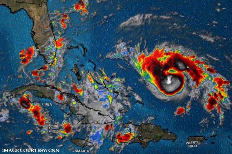
Hurricane Dorian, which has been designated as a Category 4 storm, is moving towards Florida with intensity. The hurricane has gained strength while crossing the Atlantic waters.
The “extremely dangerous” Hurricane Dorian is inching closer towards Florida, leaving forecasters uncertain over the course of the storm. The storm’s winds increased to 130 mph (215 kph) on Tuesday. Forecasters predict that the storm could gain further strength once it reaches the coast.
The National Hurricane Centre averred that according to some of the computer models hurricane Dorian might turn northward and only touch the coast. “There is hope,” Weather Underground meteorology director Jeff Masters said.
US President Donald Trump had earlier declared a state of emergency in Florida and tasked the Federal Emergency Management Agency with disaster-relief work. In Florida, the governor has enjoined nursing homes to ensure tragedies like the one that happened during Hurricane Irma in which 12 patients lost their life.
Further, NASA has moved its 380-foot-high mobile launch platform at the Kennedy Space Centre in Cape Canaveral to safety. The launch platform has been shifted to the Vehicle Assembly Building, which can withstand speed of 125 mph (200 kph).
This development comes at a time when meteorologists have expressed fear that Dorian can become the most powerful hurricane to hit the east coast of Florida in about 30 years. The National Hurricane Centre had predicted on Friday that the hurricane will hit near Fort Pierce, some 70 miles (115 km) north of Mar-a-Lago. They, however, added that the course of the storm is still uncertain.
The hurricance centre avowed that coastal areas could get 6 to 12 inches (15 to 30 centimeters) of rain. FEMA official Jeff Byard stated that the hurricane will likely “create a lot of havoc” for roads, power and other infrastructure.


